News
WA weather:Tornadoes possible as ‘strong’ weather system hits WA

An ‘unusually strong’ weather system that could even produce tornadoes is set to hit parts of Western Australia this weekend.
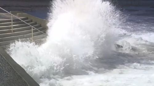
The ‘once in five years’ storm will bring devastating winds of 125 kilometers per hour, rainfall of around 50mm, swells of up to 8 meters and even a chance of tornadoes.
The Bureau of Meteorology has issued a severe weather warning for a wide area, from around Kalbarri in the north, south to Margaret River, towards Esperance and down to the state’s south-east coast.

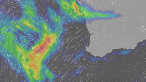
According to the agency, the affected area could expand this weekend as it is an “evolving weather situation.”
Meteorologist Ilana Cherny said today the system would cause damage with destructive wind gusts, heavy falls, very large waves and possibly localized tornadoes.
“The risk of these hazards begins tonight as showers and thunderstorms arrive,” Cherny said.
‘From Kalbarri and the central west this evening, and through the lower west and south-west into the early hours of tomorrow morning.
“The risk of damaging winds will extend further east throughout Sunday.”
Cherny said there would be a second burst of “very strong winds” with a risk of locally destructive gusts from about Lancelin to Albany.
“That risk will be for Sunday evening through Monday morning,” she said.
Severe thunderstorms may develop in the central west and extend into the lower west.
“In addition to the wind and rain we could see during the thunderstorms, we may also see some very localized tornadoes, which, if they develop, are very fast-moving and short-lived.”
(9News)
Residents are advised by authorities to ensure loose items are moved indoors or locked to prevent them becoming airborne.
Western Power has canceled all their planned outages for this past weekend and put crews on standby for possible weather-related outages due to faulty power lines.
Hillarys Yacht Club has canceled its junior sailing event as a precaution.
“Our boatmen have their skipper tickets and will be patrolling the marina and surrounding clubhouse to make sure everything is safe and there is no damage,” Rick Coate of Hillarys Yacht Club told 9News.
The warning for Australia’s west coast comes after the cancellation of a severe storm warning on the east coast, where heavy rain and gales lashed parts of the country.
The coasts of Queensland and NSW, as well as regions further inland, experienced drenching this week, caused by a low-pressure system off the coast.
Falls of up to 80mm were recorded in south-east Queensland, and up to 70mm in NSW to the central coast, with the storm warning covering the Mid North Coast, Hunter, North West Slopes and Plains and Northern Tablelands districts.
Today a new cold front is approaching the southeast of the country.
As a result, showers will increase across South Australia, Victoria, Tasmania and inland New South Wales, with colder southerly winds behind that system.